
Rudranath, perched in the upper Himalayan region in district Chamoli (Uttarakhand), is a high altitude and a rather difficult hike of almost 41 kilometers (two-way). But once you arrive at your destination, the panoramic view of the snowy mountains (or Himalayas), thick and verdant valleys down below and a mystic aura emanating out from the age-old Lord Shiva’s temple here, will enthrall you to the fullest.
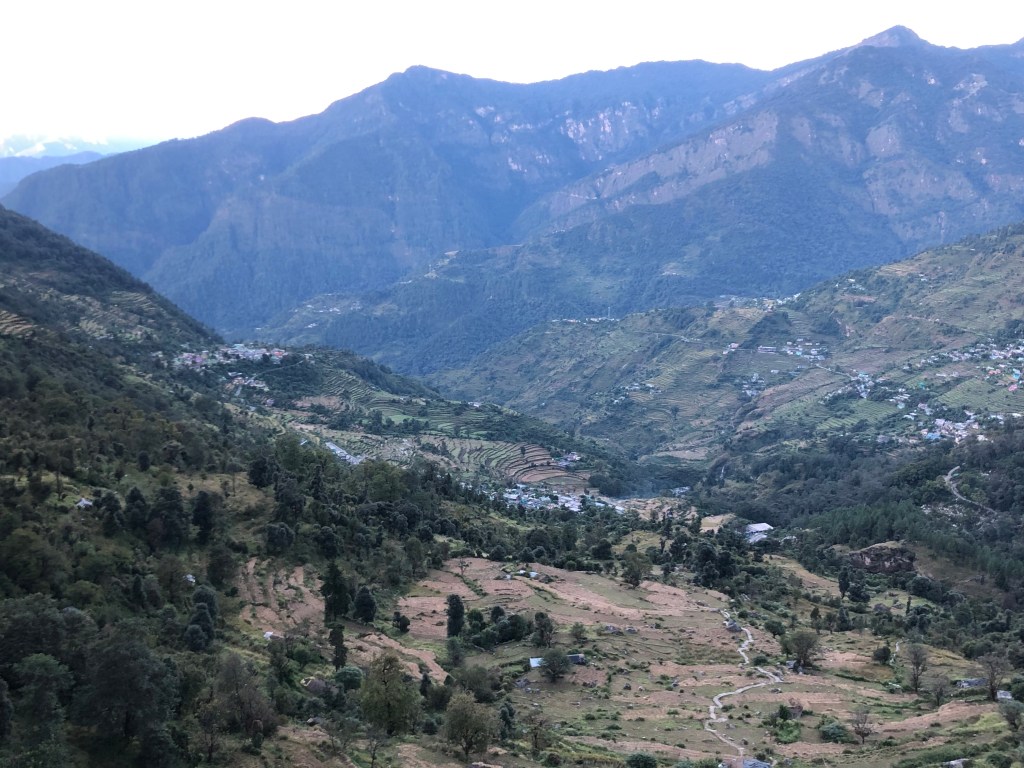
After a full day of road-journey all the way from Dehradun, we arrived at this tiny and tranquil hamlet of Sagar in district Chamoli (Garhwal region). We made a pitstop at a newly built and modest homestay located in the middle of this village. After a simple dinner, we called it a day. It was almost dawn, a short step away from that strange threshold of night-time and the daylight, when we stepped out of our slumber. The night was thick, and the eerie silence was only disturbed by that squealing sound of the wind making its way into our room through the window. We got our bags packed and soon were ready for the day’s hike.
We started our ascent at about 5 AM. The stars were still up there, bright and shining, though the effect of the rising sun was making its impact felt. Life in the distant villages was coming into action and clattering of the temple bells echoed through the far hills. As we paced further into the thick of forests, the human settlements got lost behind us.

Rudranath Trek – quick pointers on this hike
- Is one of the panch (five) kedars in Uttarakhand. These are temples dedicated to Lord Shiva. The other kedar temples include Kedarnath, Madhmaheshwar, Tungnath and Kalpeshwar
- As per the Hindu mythology, it is here that the Pandava brothers saw Lord Shiva’s face and therefore this temple is called Rudranath as it shelters the face of Lord Shiva.
- If you wish to read this interesting story about the search of Lord Shiva by Pandava brothers in Uttarakhand, you can refer to my dedicated post here
- Is the most challenging of all the panch kedars in terms of the distance to be covered, path condition, altitude gain, and availability (or rather un-unavailability) of wayside amenities
1st leg :- Sagar village to Pung Bugyal | 4 kms | easy to moderate

Hike through the village and then through a forested patch. This section is relatively easy and surely prepares you well for the next legs. Pung is a small meadow (bugyal) perched on a knoll. Panar top, the highest point of the hill directly facing Pung is distinctly visible from here.
2nd leg :- Pung Bugyal to Lyuti Bugyal | 5.5 kms | moderate to difficult
- Pung Bugyal to Kalchat – 2 kms
- Kalchat to Moli Kharak – 1.5 kms
- Moli Kharak – Lyuti Bugyal – 1.5 kms
The hike is pretty much through the forests and is relatively ok until the next stop i.e., Kalchat. From here, it’s a steep incline until Lyuti. While the path is clearly there, there are broken patches at places, and one needs to be careful throughout. Especially with the ponies that emerge out of nowhere and scramble up the hill without giving you a warning. But what will please you more are the views of the valley below. Sagar village is now visible again, though only in the form of tiny, scattered dots.
Lyuti bugyal has quite a few temporary sheds that offer stay options as well as food. Some people decide to make a halt here for the day and then continue further the next day.
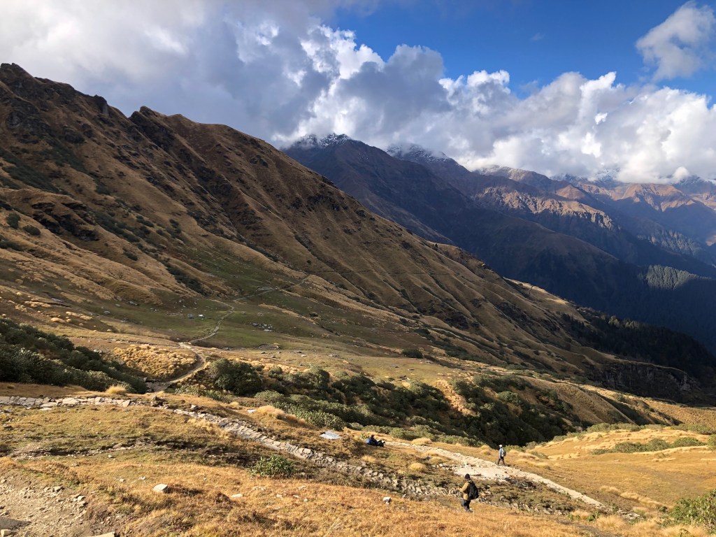
3rd leg : Lyuti Bugyal to Panar Base | 2 kms | moderate to difficult
This stretch is quite like the previous one, however you get something unique on this stretch. ‘The Himalayas’. The mighty peaks will start unfolding in-front of you on this stretch and hereafter. On the east, Alaknanda River, clearly visible, navigates through a passage between the mountains in the distance.

Panar Base feels like heaven. It’s the top of that vertical hill that we saw from Pung and you really feel a sense of accomplishment having made it here after a tiring (but enriching) effort of almost 5-6 hours. From here, an 1800 view of the Himalayas is distinctly visible. Peaks such as Nanda Devi, Dronagiri, Trishul, Nanda Ghunti, Hathi Parbat and others can be pinpointed easily. The wind is strong here and it makes an eerie sound as it hits you on the face. It was a clear day, and the sun was bright and so we decided to take an hour break here and soak in the milieu as well as enjoy a sumptuous meal of ‘Chainsu-bhaat’ – a local, high carb meal, popular in the Garhwal region.

4th leg : Panar Base to Pitradhar | 3-4 kms | moderate to difficult
From Panar base we cross over to the other mountain through a stretch of alpine meadows. There’s a forest check post here and non-locals are required to get themselves registered and have to also pay a nominal fee.

This stretch is a good mix of up and down trails, but the vegetation line starts to recede, and the wind gets heavy. You clearly witness the change of weather on this run.
5th leg : Pitradhar to Rudranath | 5 kms | moderate to difficult
- Pitradhar to Panch Ganga – 2 kms
- Panga Ganga to Rudranath – 3 kms
You now are literally trotting in a high-altitude zone where weather changes so rapidly that you can be caught off-guard. Winds are strong and patches of snow can be seen in sections hidden from the sun light. Vegetation is minimal here, expect for some alpine shrubs, birch trees and some variety of rhododendrons.
Pitradhar is the highest point of this trek (approx 4000 meters) as we scramble down (altitude-wise) from here until Rudranath. From here, you can witness the pristine Urgam valley and beyond or look behind and admire the silhouette of the mountains that encompass the districts of Chamoli, Rudraprayag and Pauri.
Panch Ganga derives its name from 5 water springs (quite functional). Note – On our return journey the next day, we took another route, and it is here that the route diverges from the main trek path that we are discussing on this post.
Rudranath shows you up a 1 kilometer before you arrive there. A thin straight-line of temporary structures perched on a mountain whose higher reaches is clad in snow, makes you wonder how on earth someone really discovered this place in those times.
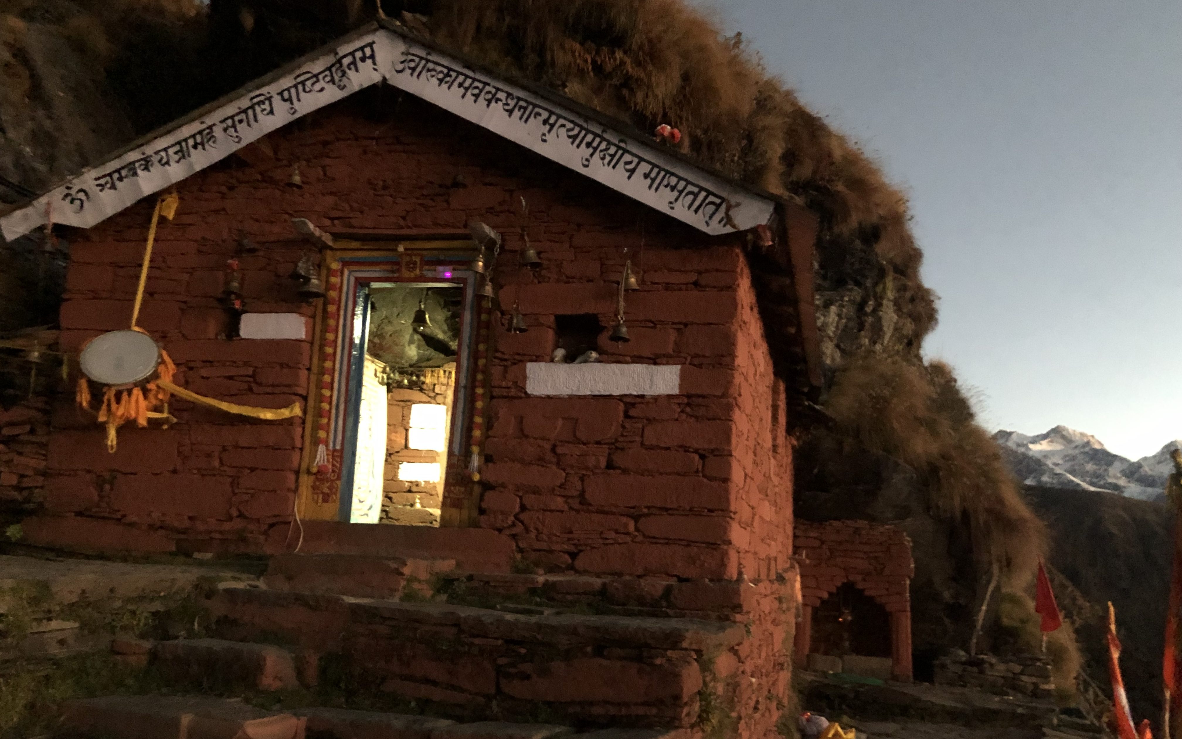
After 11 hours of walking between about-dawn and about-dusk, we finally arrived at Rudranath. After taking some rest, we paid our obeisance to Lord Shiva, and then joined in the evening aarti.
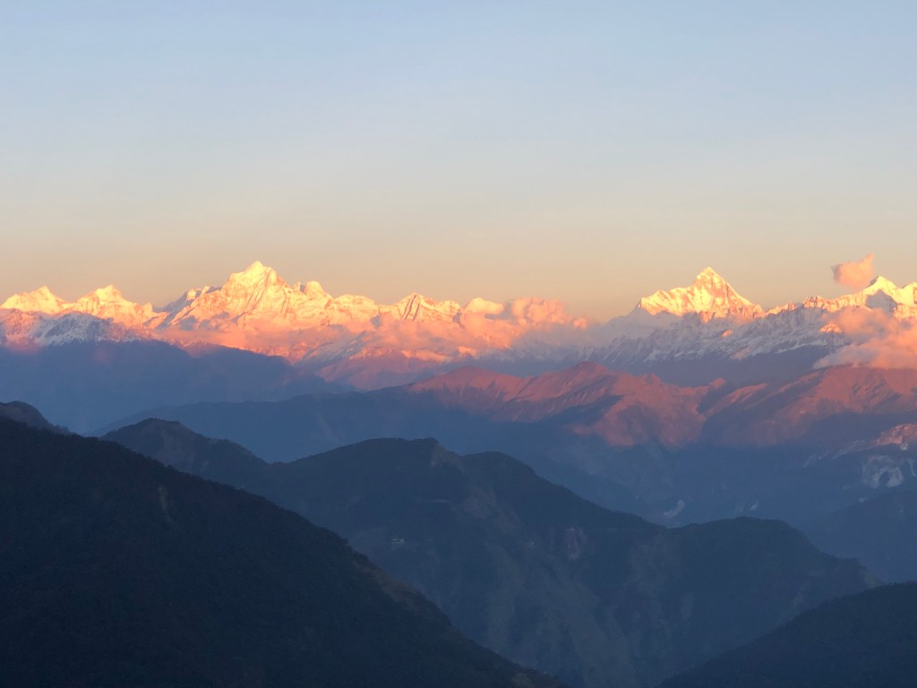
The hues of orange and red (from the setting sun) mixing with the pristine white of the Himalayas, the melodious tone emanating from the conch shell being blown by the temple priest and the synchronized chanting of ‘Jai Bhole Nath’ by devotees being carried far and wide through the damp air, we truly felt blessed to have made it here.
I hope that you enjoyed the post.

Nice details and more than that lovely pics
LikeLiked by 1 person
I am glad you enjoyed the post.
LikeLike
This is awesome. Keep up the good work, Saurabh
LikeLiked by 1 person