
Dayara is one of the popular treks nestled in a remote part of Uttarkashi district, Uttarakhand. And there are reasons why trekkers or enthusiasts are pulled towards it. So, what is it that makes Dayara so special?

Why should you consider the trek to Dayara?
- Dayara Bugyal or meadow is a heap of undulating land that is blessed with flowers during the spring and autumn seasons. Even in the winters, one would get smitten by its appearance and the thick snow would be a perfect add-on
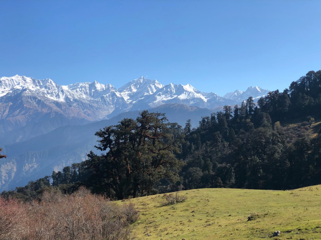
- The view of Garhwal Himalayas is magnificent from here with peaks such as Srikantha, Gangotri (I, II, III), Jaonli and Draupadi Ka Danda (DKD) clearing visible on the eastern front
- On the northern front, you get stunning views of Bandarpoonch (I and II) and Kalanag peaks
- It’s not a difficult climb and therefore even the novices can consider the hike. Out of the world experience is guaranteed.
- It doesn’t hit you timewise too. Dayara can surely be one of your options if you are scouting for 1–2-day treks
Let’s dig deep and take you on a journey to this pristine land. The trek was undertaken in the week1 of November’2022.

Leg1 – Dehradun (altitude – 640 mtrs) to Raithal (2130 mtrs) via Chamba | 235 kilometres – 8 hours’ drive
The road conditions have drastically improved as majority of this route (barring the last 12 kilometres) falls on the char-dham network that goes all the way to Gangotri. At Bhatwari, we leave the Char-Dham highway and take the narrow (but in good condition) road to Raithal village. It’s a large village by the hill standards.
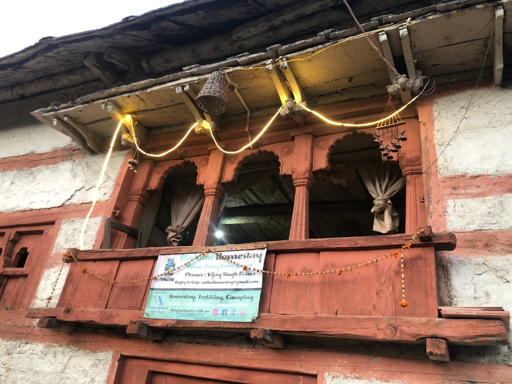
We stayed overnight in an ancient property (homestay) by the name ‘Raithal Homestay’. It was a unique experience to stay in a traditional Garhwali house. It had a lower portion (meant to keep the cows and other animals) and an attic ( approached by a wooden staircase that would produce a creaky sound on every press of your foot). The interiors were done in mud and the exteriors in wood and stone. Intricately carved out windows unleashed the beauty of the village down below and of the distant hills.
The weather was cold by the time we arrived at Raithal in the evening. After a quick and simple meal, we called it a day.
Leg2 – Raithal Village (altitude – 2,130 mtrs) to Dayara Bugyal Top (3,676 metres) | 9 kilometres walk | 4.5 hours
We got up by 6 AM and were greeted by the tall Himalayan peaks in the distance with the rays of the sun thrusting upon them.

We got our breakfast packed and at 7:30 AM we started our accent towards Dayara. For the initial 500 metres, you pretty much navigate through the village, carefully examining the everyday activity of village folks and greeting them with a smile and in return getting their wishes and motivation for the trek.
The table below mentions the pit-stops on the way.
| Name | Distance | Altitude (in mtrs) |
| Raithal | 0 kms | 2,130 |
| Gui | + 4 kms | 2,961 |
| Chilapada | +1.5 kms | 3,153 |
| Dayara base | +1.5 kms | 3,342 |
| Dayara Top | +2 kms | 3,676 |
| TOTAL | 9 kms |
Broadly, the climb is of an easy grade except in a few patches where the gradient is high. All the key stops ahead of Raithal are meadows in their own unique ways with Dayara being the biggest of all. It stretches far and wide. The entire route is through thick forests and the constant chirping of the birds makes the hike more interesting.

Stunning views from Dayara Top are guaranteed. 180-degree view of the Himalayan peaks and a top view of the vast and endless meadows down below.

After spending a few minutes and absorbing the whole grandeur of the surroundings, it was time for us to scramble down, all the way to Raithal.
Leg3 –Dayara Bugyal Top (3,676 metres) to Raithal Village (altitude – 2,130 mtrs) | 9 kilometres walk | 2 hours
The return trek was relatively easier and quicker for us. The key reasons being a) the path is well laid out and b) the gradient (of descent) is easy.

On our way back, in the full glimmer of sunshine, when we glanced through an opening through the thick trees and shrubs, and saw Raithal village, it looked heavenly to us. A tranquil village parched on a piece of land and surrounded by these mighty hills on all sides.

At Raithal, we concluded our trek and commenced our road journey back to our base in Dehradun.
Note – Dayara Bugyal is the one of the few treks that can be attempted at any time of the year.
