My last few posts have been covering the rivers of this majestic doon valley. In this blog too, I present to the readers a very interesting trail following the path of the Tons River. The river follows an interesting path and passes through some very important landmarks that are frequented by the people from Dehradun / tourists.
Note: – There is another Tons River that forms the borders of Himachal Pradesh and Uttarakhand. This is a bigger river that eventually drains in the Yamuna at Dakpatthar near Vikasnagar town (District Dehradun). The one we are discussing here is a small perennial river that flows through Dehradun city.
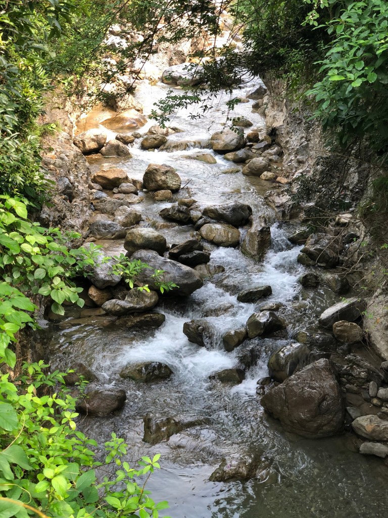
Source of the Tons River (Dehradun) – The waters are drawn from the numerous springs / other sources in and around Mussoorie. It also derives the water from the famous Bhatta falls (on the Dehradun – Mussoorie highway). All these water sources eventually meet at a place where we have a hydroelectric project (known as the Glogi Hydro-power project). One can walk all the way upto this project site and all along, the Tons will accompany you.
Unique aspects about the Tons River trail
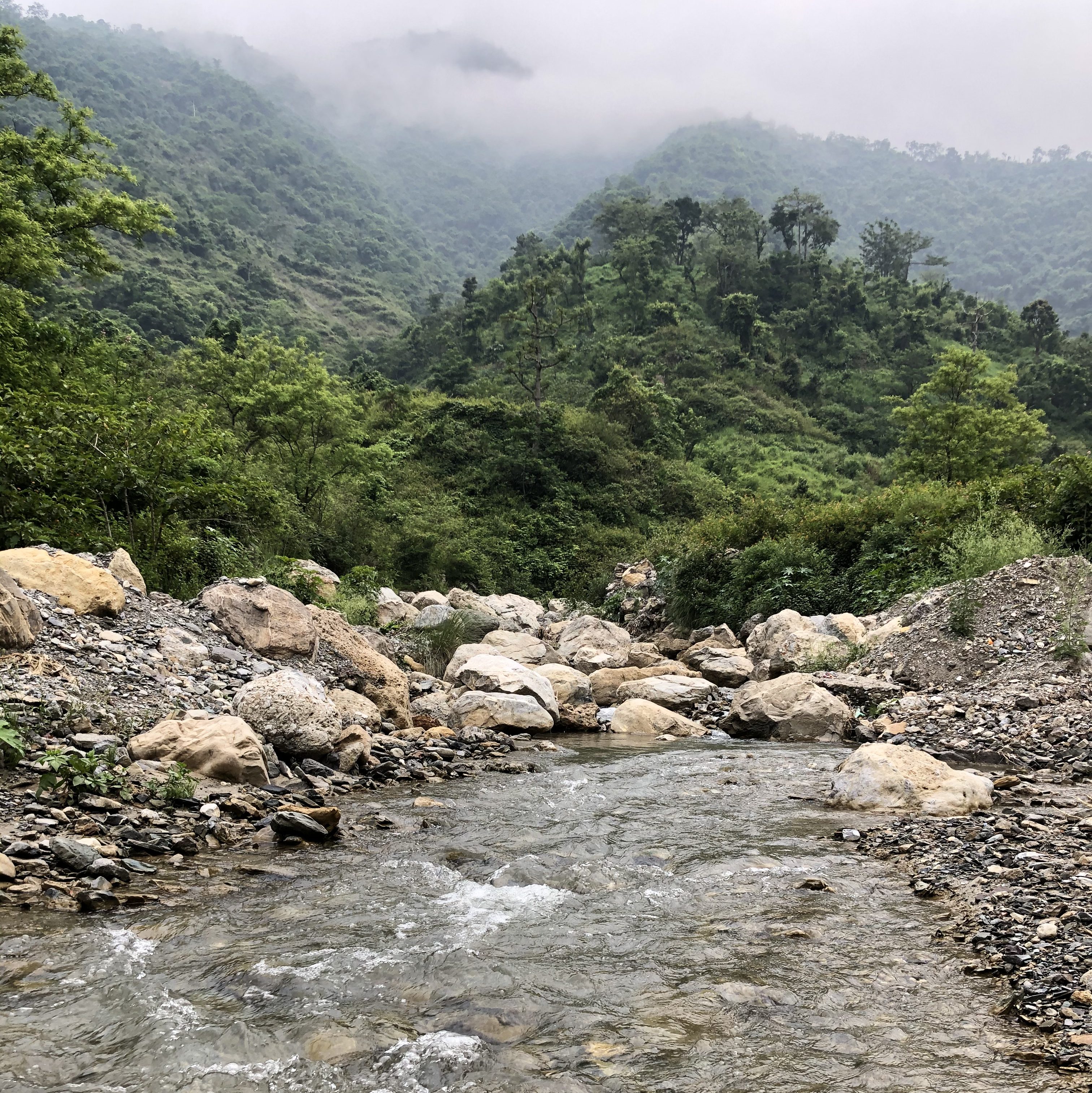
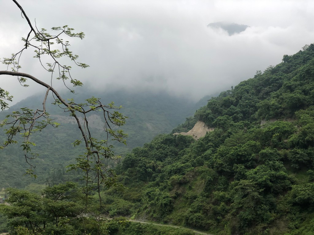
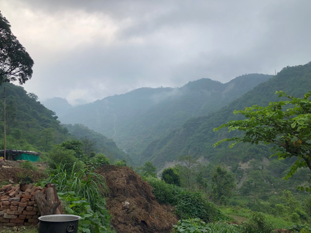
- The source of the Tons River (area near the Glogi hydro project) is nestled amidst dense green forests and is located right at the base of the Mussoorie hill
- The views are breath-taking from here
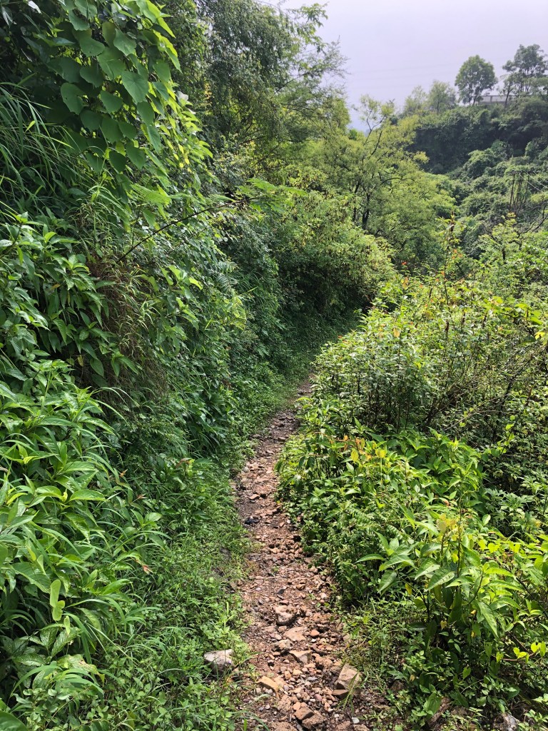
- The drive to this place is equally scenic as you cross the entire doon valley and this part of the valley is less crowded with the urban civilisation (you cross Sinaula , Saloniwala and Purkul Gaon). The motorable path ends just beyond the Purkul Gaon
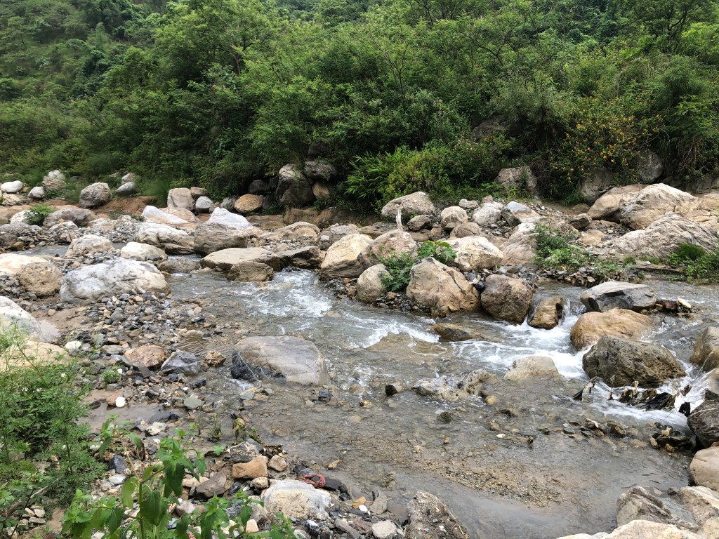
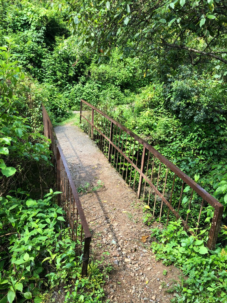
- The trail involves an easy walk of about 2.2 kms with complete tranquil (except the chirping of the birds)
- After the initial 500 metres, the rest of the walk is all along the Tons river

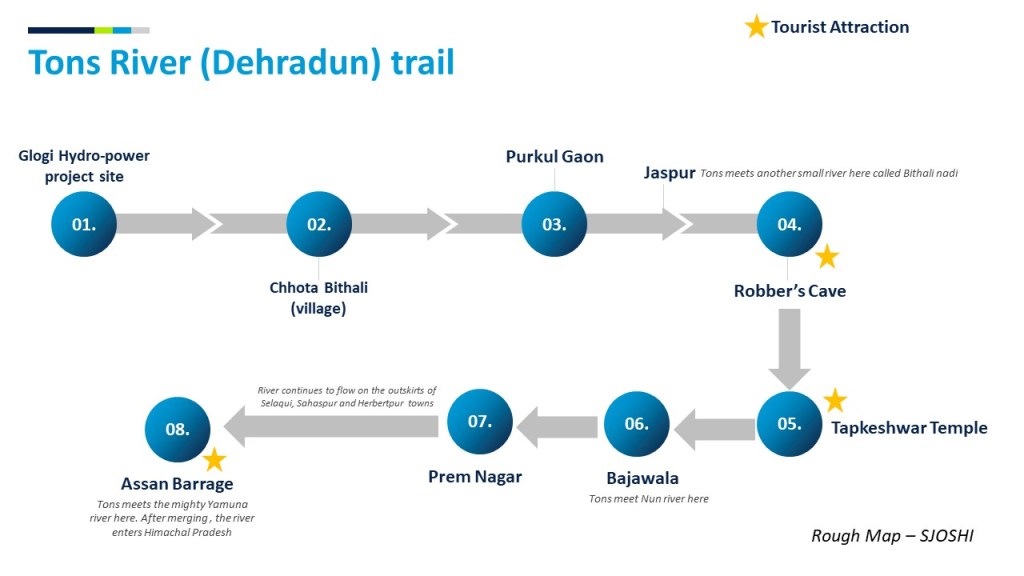
The downward journey of the Tons River
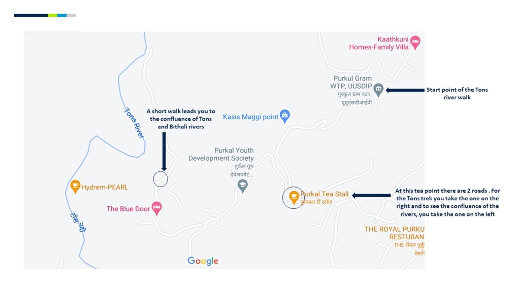
Tons River enters the Purkul village and here it meets another small river called the Bithali river. One can walk to this confluence point. It is a beautiful place and surely a traveller’s delight. The merged river flows downwards and goes through the famous Robber’s Cave (GuchhuPani). This river then continues its journey to the Tapkeshwar temple. It merges with the Nun River at Bajawala and then onwards it flows westwardly until it merges with the Yamuna River just outside Herbertpur.
Summarizing the route
| S.No. | From | To | Distance | Details |
| 1 | City Centre (Ghanta Ghar) | Purkul Gram Water Treatment Plant (WTP) | 13 kms (Drive) Approx. 30 minutes | Situated in Salangaon. You can park your vehicle in the open space |
| 2 | Purkul Gram WTP | Chhota Bithali Village | 2.2 kms (walk) Approx. 30 minutes | Beautiful walk. Hike is of easy grade and most of the path is along the river |
| 3 | Purkul Gram WTP | Punkal Gaon | 1.5 kms (Drive) – 5 minutes | another path if you wish to see the confluence of Tons and Bithali rivers |
With the on-going monsoons, the clouds made the experience even more beautiful.


What next?
This is Part-1 of the Tons River trail and I aim to write 2 more parts to cover the remaining stretches of this river.
Part-2:- We shall examine the river at Robber’s Cave, onwards to Tapkeshwar Temple, its merging with the Nun River at Bajawala and then its path when it flows out of the city premises.
Part-3:- We will follow the river path through Selaqui and Sahaspur towns and until its merging with the mighty and holy Yamuna River at Herbertpur.
Stay tuned!!

Keep up the good work, Saurabh
LikeLiked by 1 person
very simple, yet very well written article, Saurabh. You are truly in love with the Doon Valley. It is heart warming to read your description of rivers, forests, hills and birds. You are also blessed to walk these wonderful trails…
You have also given such detailed maps and guides to reach these places and follow the trails.
Really wonderful. Good luck to you on all further adventures.
LikeLiked by 1 person
I am glad you enjoyed the article. Doon valley is pristine for sure.
LikeLike