
There’s something magical about Nainital, the enchanting hill station nestled at an altitude of roughly 2,000 metres in the Kumaon region of Uttarakhand. This place is dear to me, as I spent 3 years of my formative years studying at a prestigious boarding school in the town. Sweet memories were made, and they remain tucked away in the remote corners of my mind.
In 1841, when Nainital was discovered, and its beauty first documented

The first recorded history of Nainital appears in the ‘Notes of Wanderings in the Himmala’, published in the Agra Gazetteer in 1844 under the pseudonym ‘Pilgrim’. This pseudonym belonged to Peter Barron, a wealthy sugar merchant from Shahjahanpur, who accidentally discovered the lake town during a 1,500-mile trek in the Himalayas. He stumbled upon Nainital in November 1841, and was so enamoured by its beauty that he kept the discovery a secret for a while. Barron later built Pilgrim Lodge, the first European residence in Nainital. The town continued to flourish, and when the United Provinces (now Uttar Pradesh) was formed, Nainital became its summer capital.
Fast forward to the present.
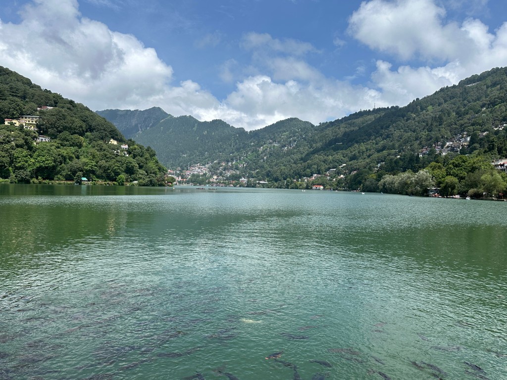
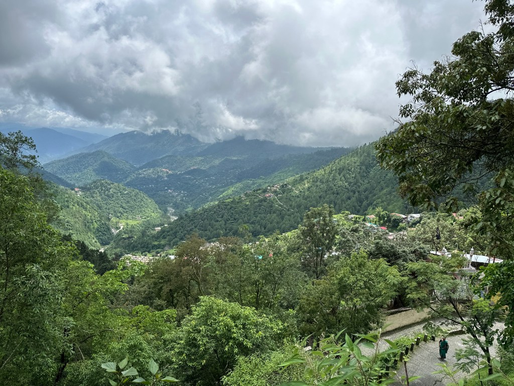
As you glance around, perched on any of the surrounding hills (Ayarpatta hill on the south side of the lake, Sher Ka Danda to the North or China peak that spirals up into the sky forming the western periphery), you instantly become smitten by the raw beauty of this picturesque town. This crescent-shaped lake reflects vibrant hues, with oarsmen gliding through the water like tiny dots, the verdant greenery appears especially refreshing after a heavy downpour, the scent of Deodar and Oak fills the air, while a cool breeze gently caresses your skin.
I had been yearning for a short hike, but the monsoon season had mostly confined me to my base in Dehradun. Finally, I decided to grab the opportunity, when in mid-August, I found a window when the rain gods seemed likely to be a bit gentler, holding back their downpour. That’s when I chose the Jeolikote to Nainital walk.
Where is Jeolikote and a bit more about this trail to Nainital
Situated on the main highway, Jeolikote is a bustling town almost at the mid-point of Haldwani & Nainital. You can find numerous shacks / restaurants and people usually make a halt here before driving further to Nainital. It has a sizeable native population and owing to the presence of a few well-known schools around, this place has seen a major transformation over the last few years.
I took an Uttarakhand Roadways bus from the ever-lively Haldwani bus station at about 8 AM. The bus was headed towards Nainital and in about 50 minutes, I arrived in this town, situated at an altitude of roughly 1,200 meters. The air was cool, with puffs of clouds scattered above, but the sun was breaking through the moist earth, and the mountain slopes were adorned in a refreshing green typical of the monsoon season.
I took a walk around the market area. The business activity was yet to commence for the day, and except for the honking of the moving traffic, it was peaceful and relaxed here. I found a local eatery and decided to have a quick breakfast as I wasn’t sure of the options ahead into the walk.
And thus began the walk from here to Nainital.
Stretch1: Jeolikote to Veerbhatti
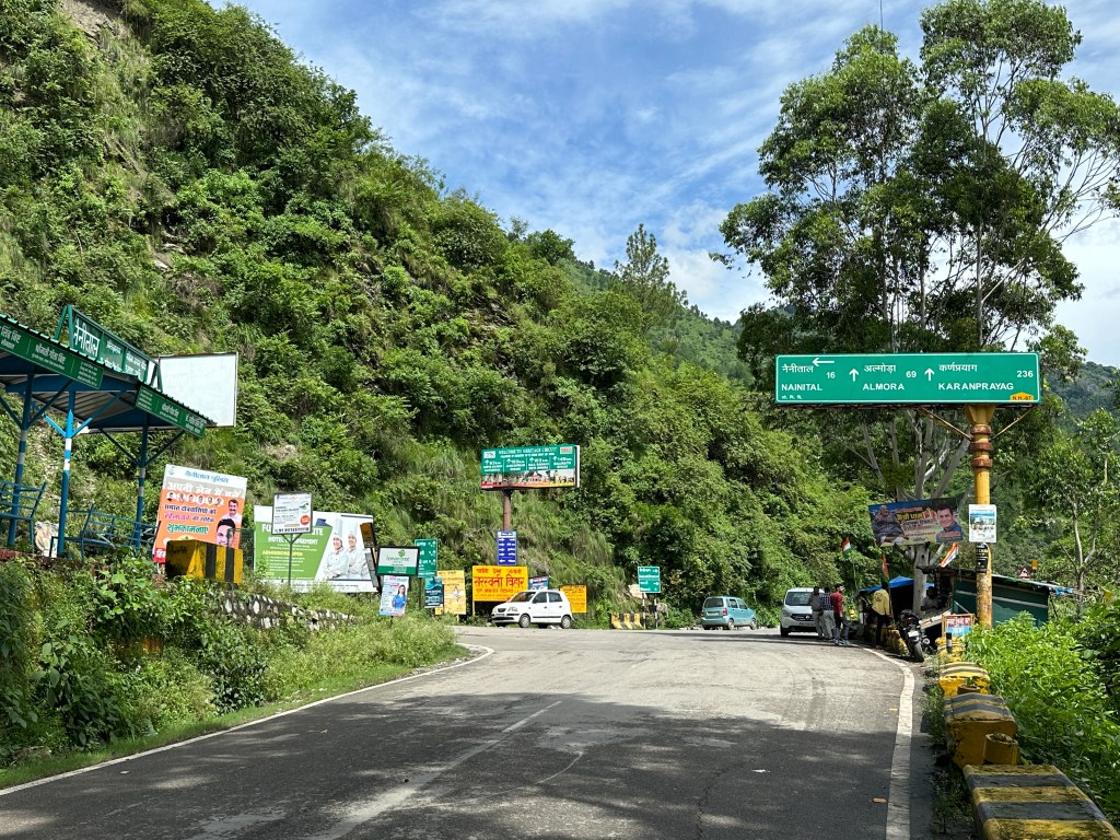

This section of the walk was simple, as it involved walking along the main highway for about 4 kilometres. I passed the Nainital bend, locally called ‘Ek Number’, and continued along the Bhowali road. The slopes, covered in lush greenery, and roadsides lined with lantana bushes bearing colorful star-shaped tubular flowers, offered just the right motivation to keep moving forward. The smell of moist earth and the constant chattering of the avian creatures further added to this magnificent aura.

Veerbhatti greets you with an array of tea and snack shops, though there’s little else besides these eateries. I took a short pause here, drawn in by the rich smell of freshly prepared aloo ke gutke, the aroma of the ginger-laced tea being brewed, and the spices wafting from boiling maggi noodles. I savored the moment, enjoyed a steaming cup of tea, and learnt about the area’s famous resident ‘Dan Singh Bisht’, popularly known by the locals as ‘Dan Singh Maldar’.
Stretch2 : Veerbhatti to Tallital

Just ahead, a bridge extends over the rushing waters of a stream emanating from the Naini Lake, eventually joining the larger Gaula river near Ranibagh, a few kilometers uphill from Kathgodam. This bridge is a popular spot, drawing crowds eager to snap photos and create Instagram reels, the new-age sensation. For our journey to Nainital, however, we take a detour before the bridge, and tread along a narrow towards Parvati Prema Shah Jagati school and onwards to Nainital. Clear directional signs are visible on a rock and on a billboard. Though narrow, the road is well-maintained and motorable all the way to Nainital, except for a few hundred metres where it abruptly ends near the notorious Baliya Nala.
5 minutes into the uphill path, just after the first bend, I stumbled upon a small grocery store. The owner seemed knowledgeable about the area’s history and also showed me the remnants of a beer factory that once stood here over 100 years ago.
About Nainital Brewery Company


I learnt about this company from an old gazetteer (of the United Provinces of Agra and Oudh) written by Mr. HR Nevill (an ICS officer) in 1904. He mentions in the book that this English brewery was established in 1876. In 1882, the then Commissioner of Kumaon, Sir Henry Ramsay, connected Nainital to Kathogodam by road. Eventually the railway line reached Haldwani in April 1884, and then extended to Kathgodam by October of the same year. This development significantly increased the movement of the people between Nainital and Kathgodam, benefiting the brewery as well. Some say that the place was earlier called Beerbhatti (Bhatti means a factory in Hindi) which eventually evolved into its current name, Veerbhatti.
As I trudged along the circuitous path onwards to Nainital, I noticed shards of dark green glass scattered along the way, lending me to believe, as the locals suggested, that they belonged to the old brewery. Nainital, throughout its documented history, has experienced several landslips, including the infamous landslide on 18th September 1880, which claimed the lives of 151 people. Other significant landslips were recorded in 1898 and 1924, and these latter events also impacted and finished off the brewery. Eventually, the entire area around Veerbhatti was acquired by Dan Singh Maldar, a prominent timber merchant of that era, whose businesses extended across several countries.
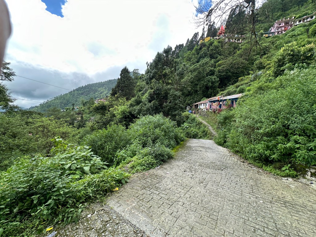
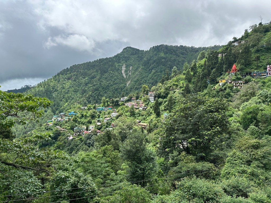
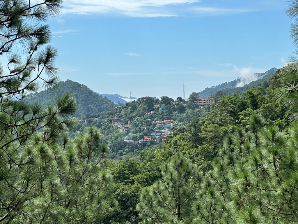
This path leading to Tallital was a steep, winding incline. About a kilometer into the hike, I arrived at the renowned Parvati Prema Shah Jagati School in Durgapur. Beyond this, the road constricted further, and the gradient remained steep. The settlements became visible as I passed through the Talla Krishnapur area, while above this area was the Malla Krishnapur neighbourhood, both of which had several households, making me realize that I wasn’t far away from my destination.
From a vantage point, as I glanced down the hill, a sweeping view of the landscape unfolded beneath. The distant settlements of Jeolikote now appeared as tiny specks.

Earlier, I mentioned Baliyanala, and now I bring it up again. This section, a gorge between the Tallital and Kalakhan has long been treacherous and prone to landslides. This path from Veerbhatti abruptly ends roughly 800 metres before reaching the main Nainital – Haldwani highway in Tallital, where fortification work is currently underway. Travelers coming from Veerbhatti to Nainital must park their vehicles here, as it’s impossible to take them all the way to Nainital.
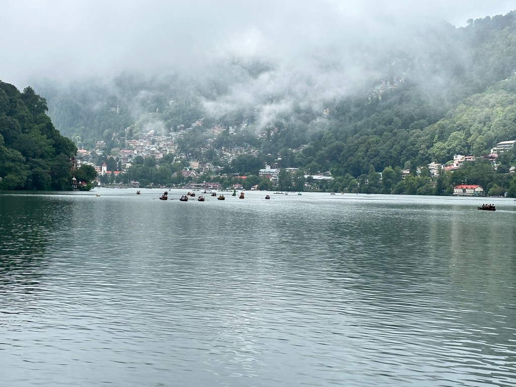
Once I reached the main Nainital – Haldwani highway, it was another 600-metre walk to Tallital Daat. Upon arriving, the majestic Naini Lake greeted me in its pristine form. Mist descended heavily, gently striking the lake’s surface, while in the distance, the mighty China peak glistened under the rays of the sun. A puff of cool breeze brushed against my skin, easing the sweat earned from this successful 7.5 km uphill walk. I relished the moment.
With this, I conclude my post and truly hope that the readers enjoyed it.
Keen on this walk? Here are a few pointers that might help with your planning.
| Total Distance / Time taken | Jeolikote – Veerbhatti 3.5 kms / 1 hour Veerbhatti to Tallital (Nainital) – 4 kms / 2 hours |
| How to arrive at Jeolikote | Option1: – Take an Uttarakhand roadways bus from Haldwani or Kathgodam bus station. This is the cheapest option. Time taken – around 1 hour or less. Option2: – Take a shared taxi from the Taxi stand at Haldwani. |
| Google map links | Jeolikote https://maps.app.goo.gl/6i2mQqDx1juch6Re8 Veerbhatti https://maps.app.goo.gl/4KwfdsW47eNadTMe7 Tallital Daat https://maps.app.goo.gl/Ns2hNdQMPCKeffg68 |
| Best time to travel | One can undertake this trek at any time of the year. But during monsoons, one needs to remain cautious. |
| Is the walk safe? | Absolutely. Barring a few small sections, the route is full of settlements / human activity. |
—
- If you found this article worthwhile and would like to explore more posts on Uttarakhand, you can subscribe by entering your email ID on a subscribe-link that appears at the bottom of the page.
- Furthermore, you can stay up to date with the captivating photographs from the land of gods, by following my Instagram account #travelindevbhoomi
